
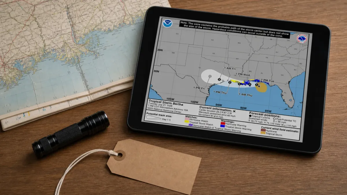
Tropical Storm Bertha is no longer just a forecast concern for the Gulf Coast. The National Hurricane Center said at 7 p.m. CDT Tuesday, July 21, 2026, that tropical-storm conditions were occurring along parts of the northern Gulf Coast as Bertha moved west with 60 mph maximum sustained winds.
The warning area runs from the Bay/Gulf County line in Florida to Morgan City, Louisiana, and includes metropolitan New Orleans and Lake Pontchartrain. A watch also covers areas west of Morgan City to Cameron, Louisiana, plus Lake Maurepas.
What changed
Bertha's center was about 120 miles west-southwest of Panama City, Florida, and about 105 miles south-southeast of Mobile, Alabama, at the 7 p.m. advisory. The storm was moving west at 6 mph, and forecasters expected a west or west-northwest motion from Wednesday through Friday.
The system was forecast to change little in strength Tuesday night before gradually weakening from Wednesday through Friday. That does not remove the short-term hazard: tropical-storm-force winds extended up to 115 miles from the center, and a 43 mph gust had been reported at Pensacola Beach, Florida.
What to check
For coastal communities, water is the main practical concern. The hurricane center said surge could reach 2 to 4 feet from the mouth of the Mississippi River to the Mississippi-Alabama border if peak surge lines up with high tide. Smaller but still hazardous surge levels were forecast for parts of Louisiana, Mississippi, Alabama, Florida and Lake Pontchartrain.
Rainfall totals of 2 to 4 inches, with isolated amounts near 6 inches, were possible through Thursday from western Florida into southern Louisiana. That rain could trigger isolated flash flooding, especially in urban areas.
Swells from Bertha are also expected to spread west along the northern Gulf Coast over the next few days, creating life-threatening surf and rip current conditions. Local officials in Mississippi, Louisiana and Florida opened sandbag sites, and AP reported that some beaches posted double red flags as surf increased.
What happens next
The next complete NHC advisory is scheduled for 10 p.m. CDT Tuesday. Residents and travelers should use local National Weather Service alerts for road, beach, surge and flood decisions, because the highest water and wind impacts can vary sharply over short distances.


