
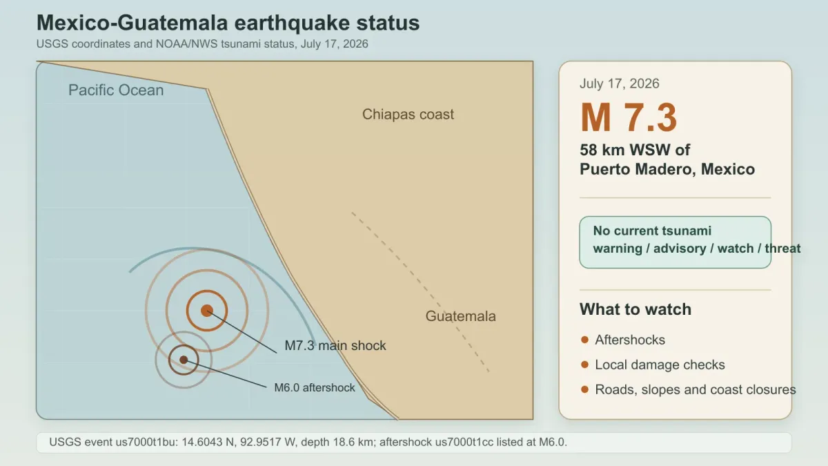
A magnitude 7.3 earthquake struck off the Pacific coast near the Mexico-Guatemala border on Friday, July 17, 2026, shaking a broad region from southern Mexico into Central America.
The U.S. Geological Survey placed the quake 58 kilometers west-southwest of Puerto Madero, Mexico, at 14:48:39 UTC, with a reviewed depth of 18.6 kilometers. USGS also listed a magnitude 6.0 aftershock about 31 minutes later, 90 kilometers southwest of Puerto Madero.
The most important update for coastal residents is that the U.S. Tsunami Warning Centers now list no tsunami warning, advisory, watch or threat for the event. Earlier concern about possible coastal waves has shifted into monitoring, damage checks and aftershock awareness.
What changed
Associated Press reported that people evacuated buildings in Guatemala City and that the earthquake was felt as far as Mexico City and El Salvador. AP also reported no immediate severe damage in Mexico or Guatemala, while Guatemalan officials described minor landslides and class cancellations in several departments.
The quake hit offshore, close enough to the coast to prompt quick tsunami questions but far enough from major inland cities that the first public reports focused on shaking, evacuations and inspections rather than confirmed large-scale destruction. That early picture can still change as authorities reach smaller communities and check roads, hillsides and coastal infrastructure.
The USGS PAGER alert for the main shock was yellow, a level that signals the agency sees a possibility of localized impact even when early fatality and loss estimates are not catastrophic. PAGER is not a final damage report; it is an early impact model that can be revised as new shaking reports and field information arrive.
What to check now
For people in the affected region, the practical advice is still conservative: avoid damaged buildings, move away from unstable slopes, follow local civil-protection instructions and be ready for aftershocks. A strong aftershock does not need to match the main quake to knock loose already weakened material.
Travelers should check airport, road and hotel updates before assuming normal service. If a beach or port area has been closed by local officials, wait for the local all-clear rather than relying on a regional summary of tsunami status.
People outside the immediate area should avoid amplifying unsourced videos or casualty claims while official assessments are still developing. The most useful checks are current local emergency notices, the USGS event page and the tsunami warning page, not recycled clips from older earthquakes.
What we do not know yet
Early earthquake reports often undercount damage in rural or coastal areas because inspections take time. The absence of immediate severe damage reports is not the same as a final assessment, especially in places where landslides, cracked roads or utility interruptions may become clear later.
What happens next
USGS will keep updating the event page as the magnitude, depth, shaking intensity and aftershock sequence are reviewed. Local authorities in Mexico and Guatemala will determine whether any coastal restrictions, school closures or building inspections remain in place after Friday's shaking.


