
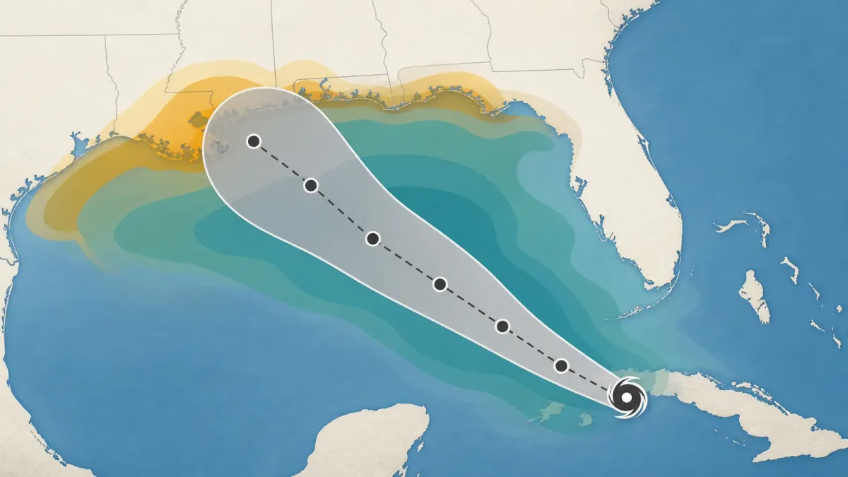
As Tropical Storm Bertha formed in the Gulf of Mexico on Monday, July 20, 2026, many people searching for the storm were looking at the same familiar graphic: a cone stretched across part of the coast.
The cone is useful, but it is easy to read too much into it. It does not mean every place inside the shaded area will get the worst weather, and it does not mean places outside the cone are safe. It is mainly a track-uncertainty tool, not a complete hazard map.
That distinction matters during slow-moving or lopsided storms, when rain, surge, tornado risk, rough surf, and tropical-storm-force winds can affect areas away from the center line. The National Hurricane Center listed Bertha near 28.6 degrees north and 86.0 degrees west at 7 p.m. CDT on July 20, with maximum sustained winds of 40 mph and movement west-northwest at 3 mph.
The short answer
Use the cone to understand where the center of a tropical cyclone is most likely to travel. Use watches, warnings, storm surge products, rainfall forecasts, and your local National Weather Service office to understand what could happen where you live.
The National Weather Service says NHC issues regular tropical cyclone advisory products at least every six hours when a tropical cyclone has formed in the Atlantic or eastern North Pacific. When coastal tropical storm or hurricane watches or warnings are in effect, public advisories are issued every three hours. That faster rhythm is a sign to check official updates more often, not a reason to rely on one old screenshot.
How the cone works
The operational forecast cone is built around expected track errors. According to the National Weather Service, the cone graphic shows the current storm position and predicted track, while uncertainty is shown so that the storm center remains within the cone about 60 to 70 percent of the time.
That wording is important. The cone describes the likely path of the center, not the full size of the storm. A storm can throw dangerous rain bands, coastal flooding, rip currents, and gusty winds far outside the cone, especially when its strongest weather is displaced from the center.
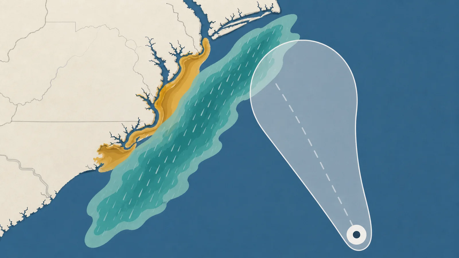
For the 2026 hurricane season, the National Hurricane Center is also issuing an experimental cone graphic that uses ellipses instead of circles. NHC says that experimental version is designed to account for both speed error and directional error, with each ellipse based on the 90th percentile of recent along-track and cross-track forecast errors.
What to check next
Start with the public advisory. It gives the storm's current position, maximum sustained winds, movement, watches and warnings, and a plain-language hazards section. If you are near the coast, read the storm surge watch or warning area separately because water risk often depends on local coastline shape, tides, and evacuation zones.
Then check your local forecast office. NHC points readers to local National Weather Service offices because local pages translate the broader storm forecast into neighborhood-level timing, rainfall, wind, marine, and flood details. For Bertha, NHC linked local information from offices including Tallahassee, New Orleans/Baton Rouge, and Mobile/Pensacola.
Finally, compare the cone with the watch and warning map. A tropical storm watch means sustained winds of 39 to 73 mph are possible within the specified area, generally within 48 hours. A tropical storm warning means those conditions are expected within the area within 36 hours. A storm surge watch means life-threatening inundation is possible, generally within 48 hours; a storm surge warning means that danger is expected, generally within 36 hours.
Common mistakes
One mistake is treating the center line as the forecast. The line can shift, and impacts do not land only on the line. Another is assuming the cone edge is a wall. The forecast can be wrong outside the cone, and hazards can spread beyond it even when the center forecast is accurate.
A third mistake is focusing only on wind category. Tropical storms and weaker hurricanes can still create serious flooding if they slow down, stall, or pull deep moisture over the same area for hours. In its Monday coverage of Bertha, the Associated Press reported that forecasters warned of heavy rain, storm surge flooding, and possible isolated tornadoes along parts of the Gulf Coast.
When to act
NOAA's preparedness guidance is simple: understand your risk before a storm, have multiple ways to receive forecasts and alerts, and know what to do before, during, and after the storm. If local officials issue an evacuation order, follow that order rather than waiting for a new cone graphic.
If you are in a watch area, use the time to review your evacuation zone, charge devices, check medication and pet needs, secure loose outdoor items, and decide where you would go if water or wind risk increases. If you are in a warning area, finish preparations quickly and stay close to official alerts.
The bottom line: the cone is a starting point, not the whole forecast. Read it with the advisory, local warnings, surge products, rainfall outlooks, and official instructions for your specific location.


